

After considerable flooding impacted Kentucky over the weekend, all eyes are now on the winter weather threat for Tuesday and Wednesday.
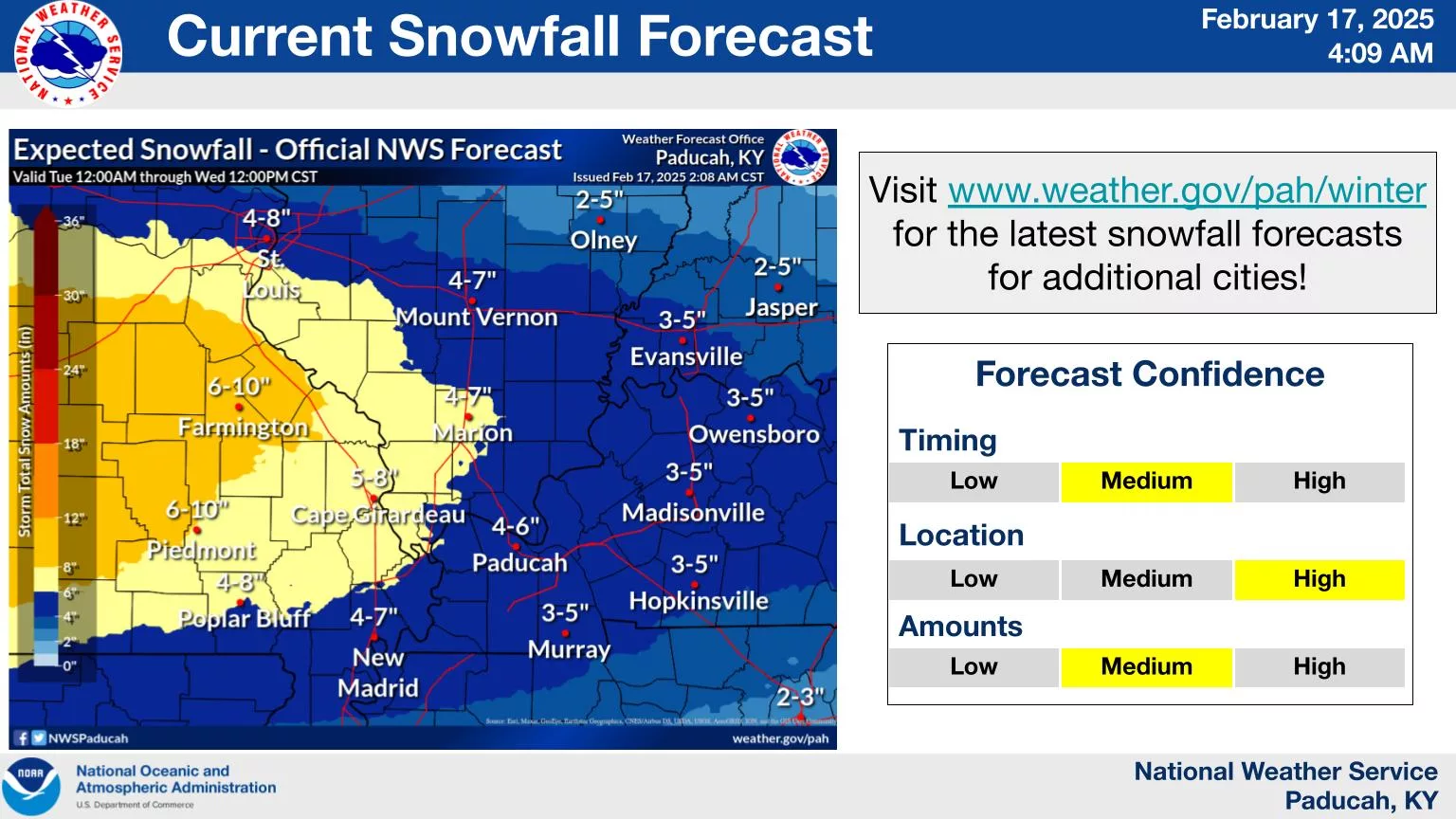
Western Kentucky:
Forecasters from the National Weather Service in Paducah said that accumulating snowfall with travel impacts is likely Tuesday afternoon through Wednesday morning. Snow totals between 3-6″ are possible. Additionally, dangerous cold is forecast for much of the week ahead. Morning wind chill values will be near or below zero Wednesday through Friday, with the lowest wind chill values expected early Thursday morning.
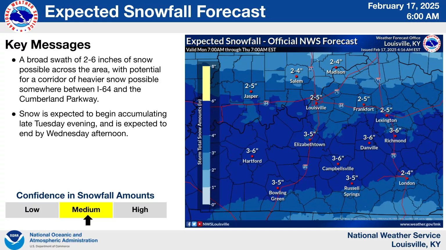
Central Kentucky:
Forecasters from the National Weather Service in Louisville said an impactful winter storm will move into the region Tuesday night and during the day on Wednesday. Snowfall totals of 3-6″ are possible. Dangerous wind chills are expected from Wednesday to Friday morning.
Eastern Kentucky:
Forecasters from the National Weather Service in Jackson said moderate to heavy accumulating snow is still possible on Tuesday night into early Thursday. Apparent temperatures of zero to ten below zero are expected at many locations late Wednesday night into Thursday morning and again Thursday night into Friday morning.